Integrated Hazard
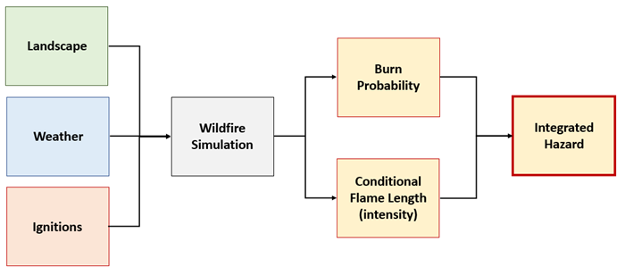
The term Hazard is used by the wildland fire community to define a variety of conditions or situations where damage to assets by fire is being evaluated. Hazard is quantified and categorized in IFTDSS using the Landscape Burn Probability (LBP) model evaluating:
- The probability of a fire occurring at a specific point under a specified set of conditions, and
- The intensity at a specific point given a fire occurs.
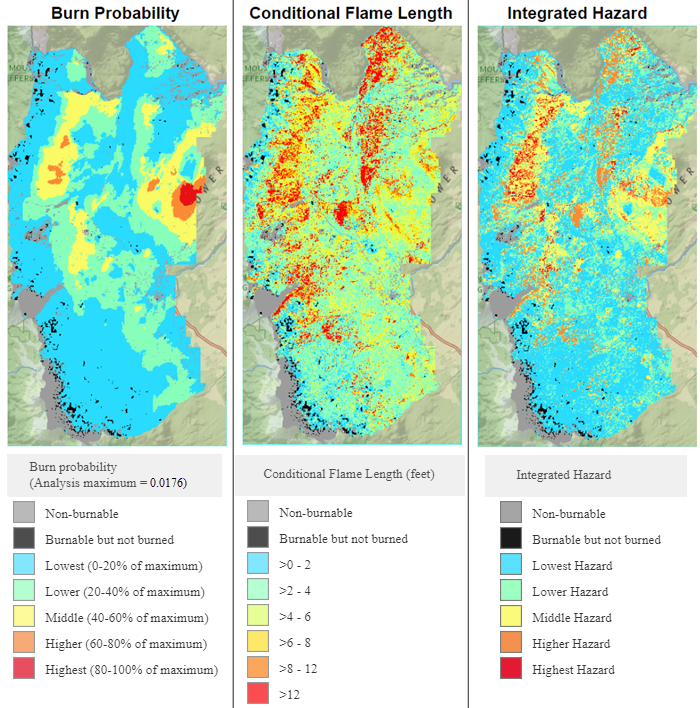
Integrated Hazard in IFTDSS combines two important measures —burn probability and conditional flame length—into a single characteristic that can be mapped. Within IFTDSS, the classified values of
Burn Probability and Conditional Flame Length are used to determine and map Integrated Hazard.
Important! Like Burn Probability, Integrated Hazard in IFTDSS is dynamic based on the extent at which it is mapped or reported. Extent options include full landscape, unbuffered landscape, and area of interest. See Masks and Map Extent (Dynamic) for an example.
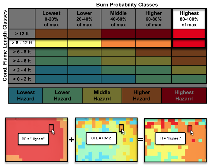
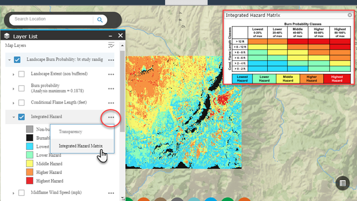
For each pixel, an Integrated Hazard value is assigned based on the Burn Probability and Conditional Flame Length Class using the following table:
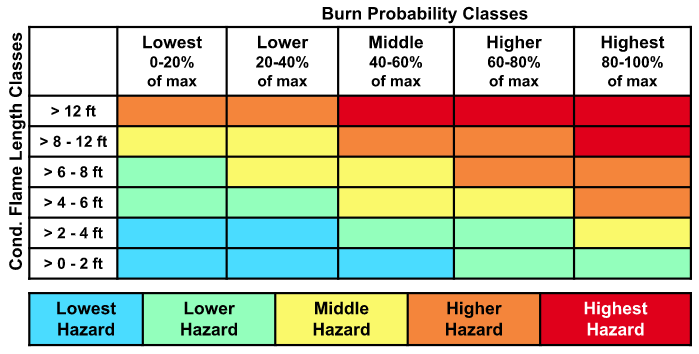
For example, a pixel with a burn probability of “Highest”, and conditional flame length of >8-12-ft would have an integrated hazard of “Highest”.
IFTDSS Integrated Hazard is categorized with seven distinct classes. The first two are for pixels that did not burn and the remaining five classes are dynamic based on the integrated hazard matrix above. They include:
- Non-burnable
- Burnable but not burned
- Lowest hazard
- Lower hazard
- Middle Hazard
- Higher Hazard
- Highest Hazard
Display
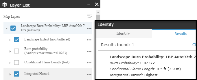
Landscape Burn Probability model outputs in the Map Studio for each specific analysis include a layer for Integrated Hazard in the outputs legend, as well as for Burn Probability and Conditional Flame Length. Integrated Hazard outputs can be viewed on the Map in the Layers List and using the Identify ![]() widget.
widget.
In Map Studio, you can view the Integrated Hazard matrix table by clicking the More Options  button next to the “Integrated Hazard” feature in the Layer List and select the Integrated Hazard Matrix option. You may click and the drag table to relocate it if needed.
Important! Places on the landscape can be unburned for three reasons: 1) the location has a non-burnable fuel model, 2) a modeled fire never reached that location, or 3) an ignition started but did not burn out of the current pixel.
Viewing Integrated Hazard from the download package
In the download package, Integrated Hazard is classified numerically. Where non-burnable pixels exist, the value is -1. Where pixels were burnable but did not burn the value is 0. The remaining values 1 through 5 represent increasing levels of integrated hazard.
| Value | Integrated Hazard Class |
|---|---|
| -1 | Non-burnable |
| 0 | Burnable but did not burn |
| 1 | Lowest Hazard |
| 2 | Low Hazard |
| 3 | Middle Hazard |
| 4 | Higher Hazard |
| 5 | Highest Hazard |