In addition to the search field, there are two methods to filter wildfires and view additional fire information:
Filter or Get More Information from the Fire List
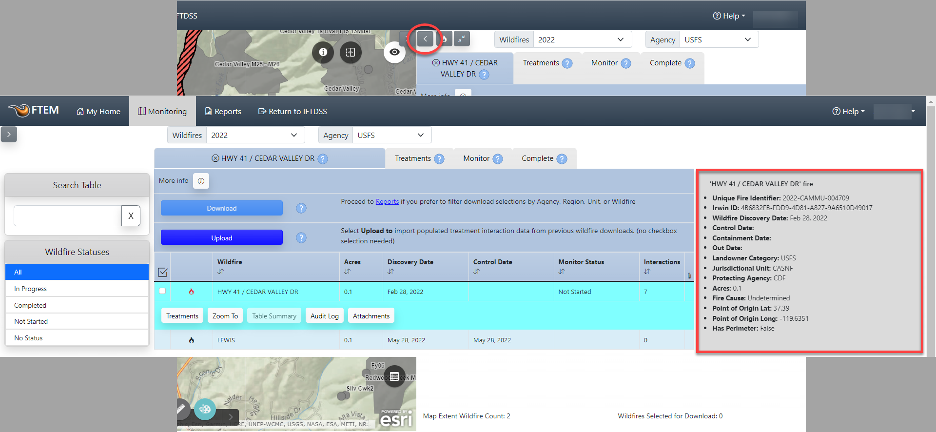
To filter fires by status or to see the full metadata for a fire, view the wildfires tab in full screen view:
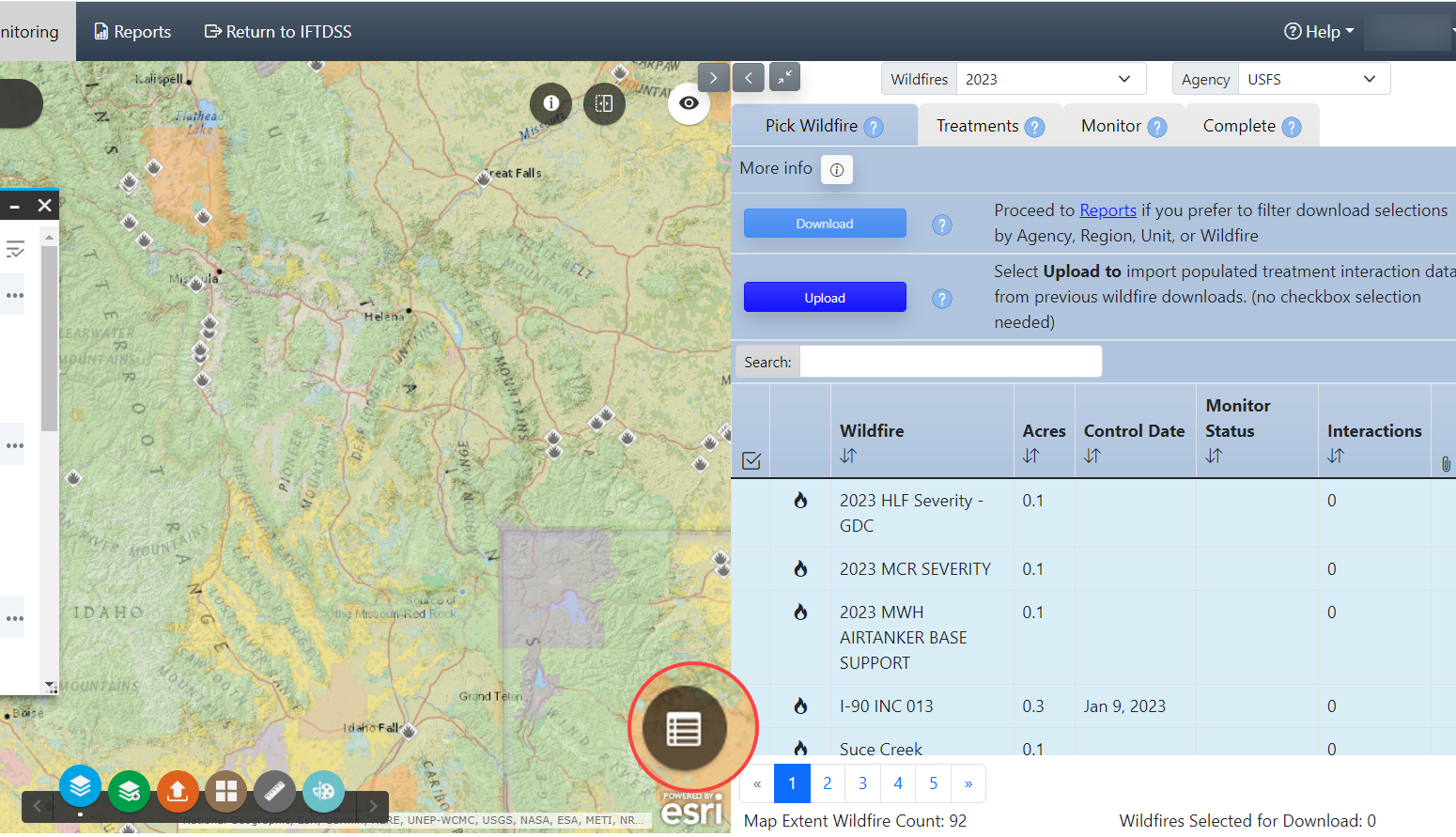
- Use the split screen button to view the fire list in full screen mode.
- Use the filter on the left to selected between All, Not Started, In Progress, Completed, and No Status fires.
-
Clicking on a fire will show fire metadata in the right hand panel.
Filter or Get More Information from the Map
Once you have zoomed into your area, you may want to further constrain the results with a specific filter term, or use some of the available FTEM Reference layers to aid in your monitoring. We'll cover these option here:
Important! Constraining the attribute table does not change the list that populates on the right of the screen until you use the "Zoom To" option to change the map extent.
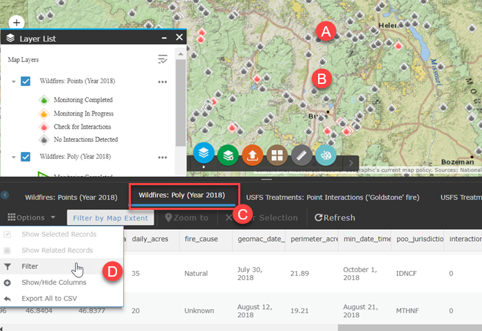
Using a Filter in Attribute Table
For this example we will search for fire polygons with a point of origin jurisdiction of Washington, Spokane District (WASPD):
-
Click Attribute Table button in the bottom right of the map.
- Use your mouse cursor to set the approximate extent of your area, the attribute table automatically populates based upon visible map extent.
- Click the layer displayed along the top of the table that corresponds with your search, in this example "Wildfires: Poly (2026)" is selected.
-
Click Options and select Advanced Filtering.
-
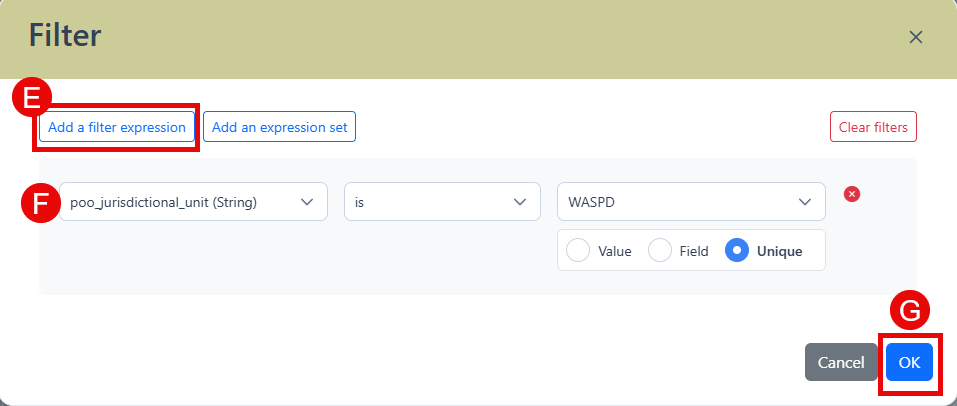
In the filter dialgue box, select Add a filter expression to view filtering options.
-
Create your filter expression and click OK. In this example we use "poo_jurisdiction is WASPD", for querying the table for Point Of Origin Jurisdiction of Washington - Spokane District (WASPD).
- Need to look up the jurisdiction code for your area? Visit the NIFC Unit ID Module .
-
We recommend including a date constraint in your custom filter. This is because the automatic "Wildfires Year" filter above the "Pick Wildfires" tab is disabled when custom filters are created.
This constrains the table to attributes that match your search results.
-
When ready, click OK in the bottom right. This constrains the table to attributes that match your search results.
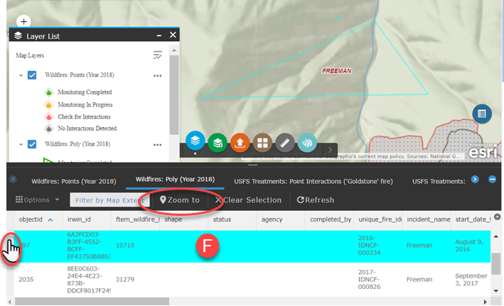
-
To zoom to a record, select it by clicking the gray area to the left of the attribute row and use the Zoom To option.
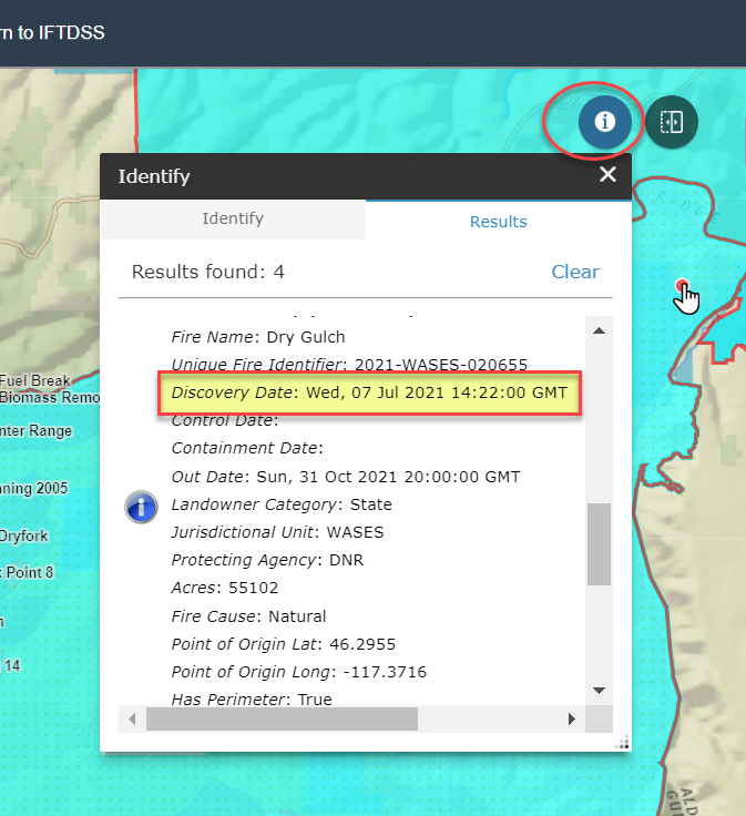
Viewing Fire Information with Identify
- Locate your fire.
- Click the Identify
 widget.
 -
Click the fire to display the information.