Creating a Shapefile Subset from the Attribute Table
Create a subset of shapefiles from a larger shapefile can be performed from the Attribute Table, as well as from the Layer List. These subsets can then be used throughout IFTDSS to represent a specific set of treatments, habitat conditions, etc.
To create a subset using the Attribute Table, with the shape visible in Map Studio, follow the steps below:
-
Click the Attribute Table widget
 on the bottom right of Map Studio.
 -
Ensure the shapefile attributes are listed on the table. If you have multiple features open in Map Studio, there may be several tabs to choose from.
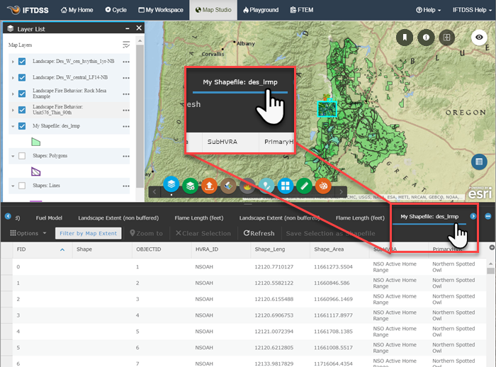
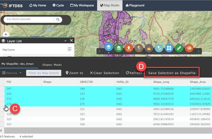
- The attribute table appears listing all the features within the shapefile. Left-click the rows for the object you wish to have contained in your subset, until you have all the objects for your subset selected.
-
Click Save Selection as Shapefile.
-
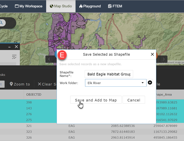
A dialogue box will appear in which you name the shapefile subset and specify the folder to save it in. When finished, click Save and Add to Map.
-
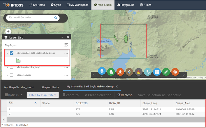
The subset of shapes will now be visible in Map Studio, visible in your Layer List, and available for use throughout IFTDSS and in My Workspace. Note that if you pull up the attribute table for your subset, all the data is retained, just as it is in the larger shapefile.