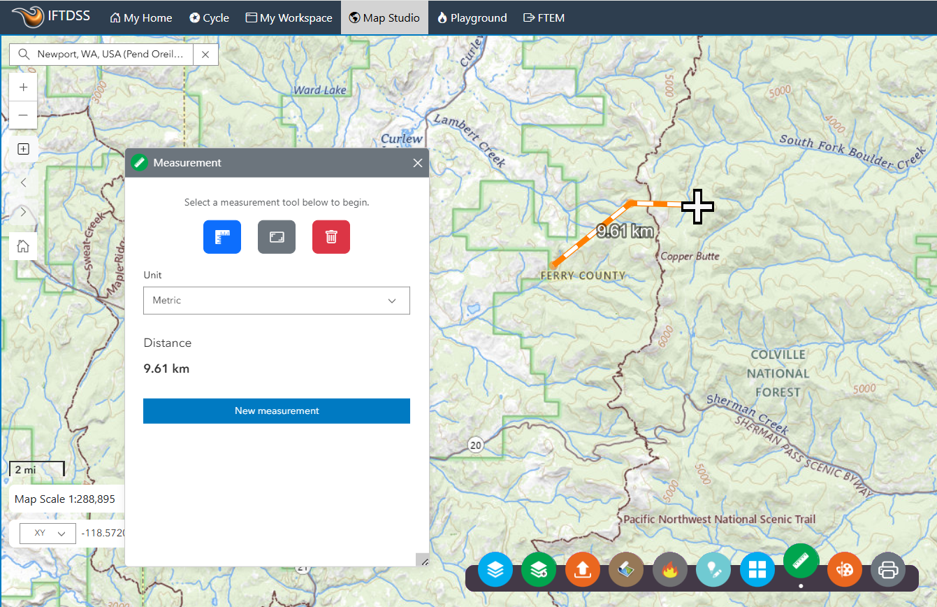
Measurements widget in Map Studio
When using a map, you can measure the area of a polygon, the length of a line, or find the coordinates of a point. Map Studio calculates the shortest distance (using the ellipsoid-based geodesic calculation) even if the data uses a projected coordinate system.
Make a Measurement
Click Measure ![]() to display the measure dialog box, your results appear within this box and on the map.
to display the measure dialog box, your results appear within this box and on the map.
- To measure an area on the map, click Area
 and click the map once for every vertex of the area you want to measure. Double-click to complete the area.
 - To measure a line on the map, click Distance
 and click the map once for every vertex of the line you want to measure. Double-click to complete the line.
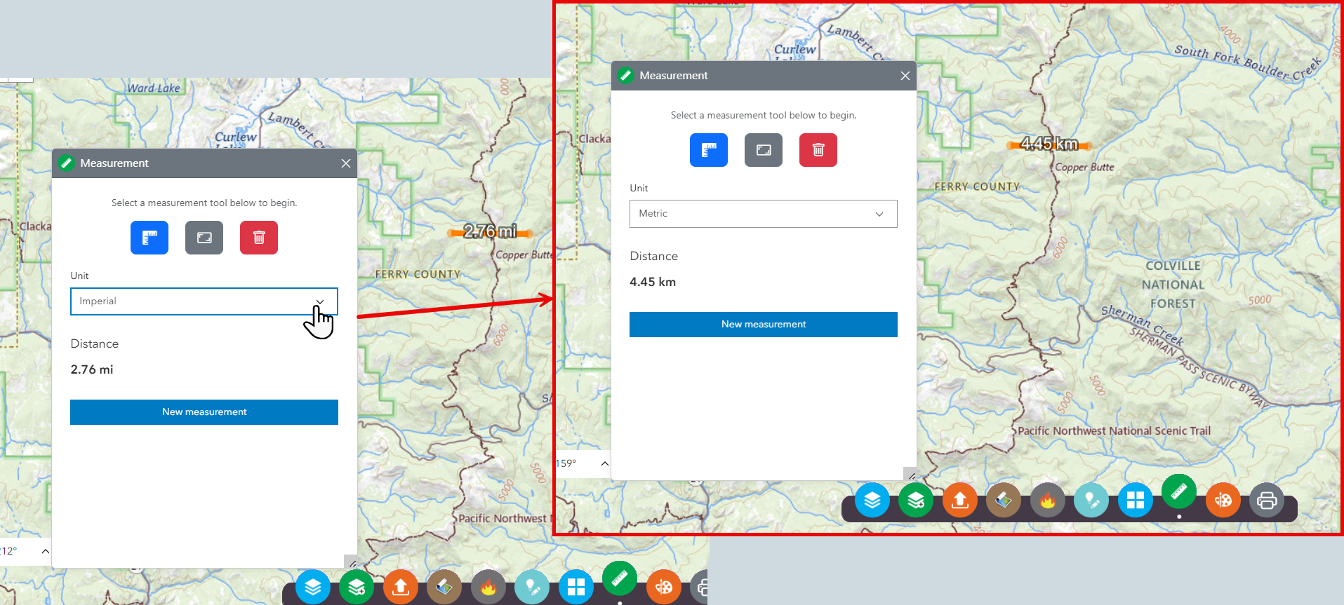
Change the Units
Once you've completed a measurement, you may change the units using the Unit dropdown menu that appears in the Measurement box. This will convert the measurement to the units selected.
Move the map while measuring
You may find that what you want to measure is not completely contained within the current extent of the map; for example, a road or parcel may extend beyond what is visible. In order to move the map as you're measuring, while still maintaining the cumulative total distance or area, you can hold down the left mouse button and pan the map in the direction you want. Resume measuring by clicking the map with the left mouse button.