Correctly Displaying MTT Embers Output in ArcPro
When viewing the embers layer from an MTT Fire Spread run exported from IFTDSS, the embers layer may not appear on screen. Upon zooming in to locate the embers layer, you will be directed on an unrelated area of the map. This occurs because the embers layer exports from IFTDSS without spatial reference.
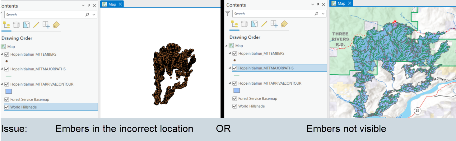
This issue can be fixed by assigning a spatial reference to the embers layer using one of other the layers in ArcPro:
-
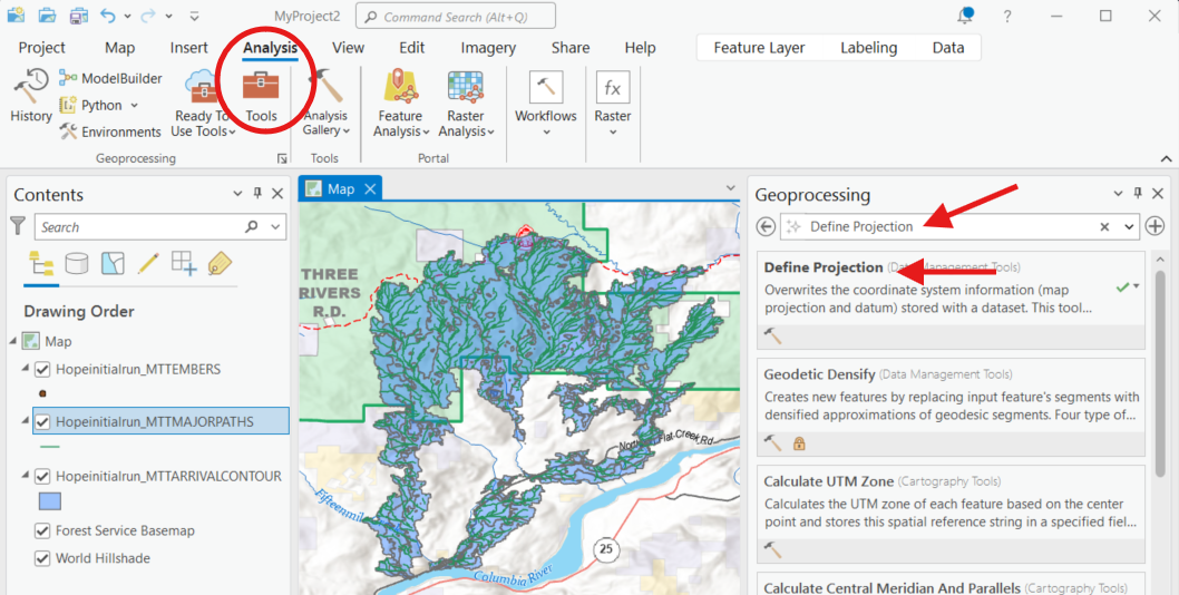
With the embers layer displayed in ArcPro, navigate to the Geoprocessing ribbon, select the Analysis tab, and click Tools.
-
When the Geoprocessing pane opens, type “Define Projection” into the search box and click the Define Projection tool.
-
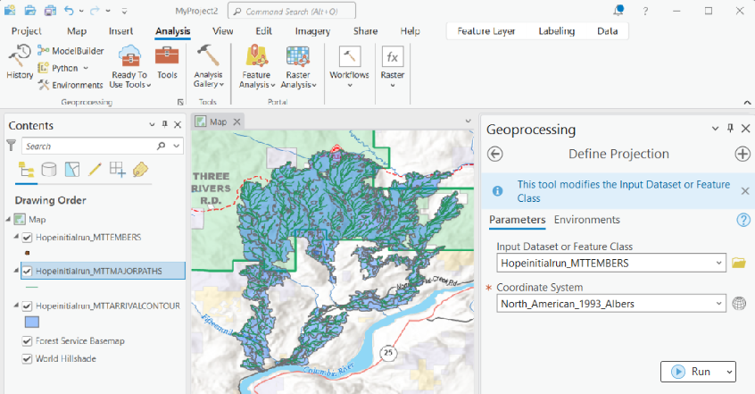
In the Define Projection pane, select the embers layer from the "Input Dataset" dropdown menu.
-
In the Coordinate System field, select any of the other layers, which contain the correct coordinate system, from the "Coordinate System" dropdown menu and click Run.
-
The embers layers will now appear correctly.