Shapes and shapefiles in My Workspace that include the Download option may be downloaded to your local computer.

Availability
Downloading a shape or shapefile will export a zipped shapefile containing the shape or shapefile you’ve created in IFTDSS. To use this feature, your shape or shapefile must fit the following criteria:
-
Be created after 01/07/2021 (IFTDSS Version 3.3.1 or later).
-
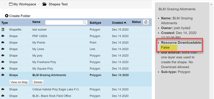
If it was copied or derived from an IFTDSS Reference Layer, it must have been copied from an unrestricted source. Certain layers are restricted for download for security reasons. You can see if a shapefile cannot be downloaded due to security restrictions by clicking on the layer and referring to the right hand panel. Restricted layers will show a “False” message in the “Resource Downloadable” field, as shown below.
Coordinate System
Shapes and shapefiles downloaded are in the GCS_Noth_American_1983 coordinate system.
File Contents
Zipped shapefiles contain the following file extensions:
-
.cpg
-
.dbf
-
.prj
-
.sbn
-
.sbx
-
.shp
-
.shp-xml
-
.shx