- Open FlamMap 5.0 (or newer).
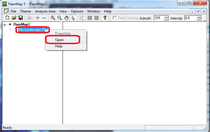
- Right-click No Landscape File.
-
Click Open.
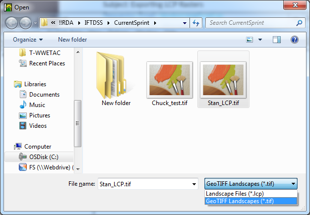
- Change the file type to GeoTIFF Landscapes (*.tif).
- Select the landscape you want to open.
-
Click Open.
-
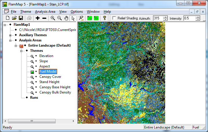
Once open the landscape has the following units.
- Elevation (m)
- Slope (deg)
- Aspect (deg)
- Fuel model (categorical)
- Canopy cover (%)
- Stand Height (m)
- Canopy Base Height (m)
- Canopy Bulk Density (kg/m3)