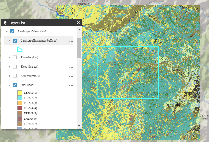
Landscapes created in IFTDSS are automatically given a 4980 meter buffer, as seen below outside of the blue boundary.
This buffer is necessary for modeling capabilities such as:
- Modeling Landscape Burn Probability requiring ignitions placed outside of a landscape so that fires can burn onto the landscape. Additionally, fires that start within the landscape must be able to burn into the buffer to avoid erroneous edge effects.
- Minimum Travel Time Fire Spread modeling where you may want to simulate an ignition that occurs outside your landscape and burns into it.
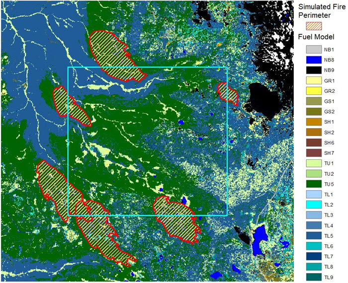
The buffer is added to allow fires to freely burn into and out of the landscape extent (non-buffered), eliminating potential edge effects where fires do not spread to their full potential, biasing the fire-size distribution and therefore burn probability. The buffer distance was chosen because Landscape Burn Probability models single burn periods, and under most fuel and weather conditions the longest axis of a fire does not exceed this distance, meaning edge effects will not impact the model outputs used in reports and subsequent analyses.
Pictured below is a sample of simulated wildfire perimeters from Landscape Burn Probability model showing the need for a buffer to allow these fires to freely burn into and out of the Landscape Extent (non-buffered) portion of a Landscape.
The Landscape Extent, beyond which the boundary extends, is delineated by the blue line when viewing it in Map Studio. This line may be hidden by unselecting it in the Layer List.
Buffering and Reports
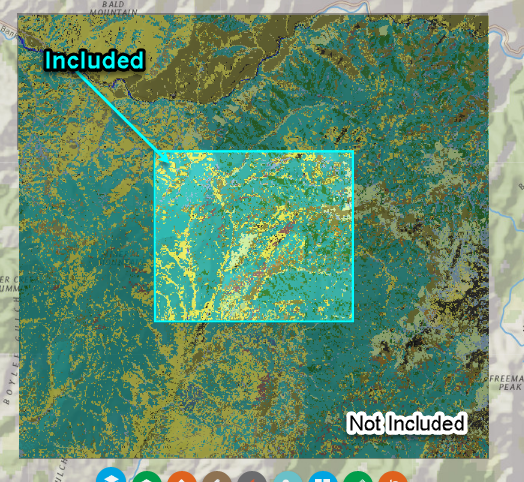
The buffer around your landscape (the area outside the blue landscape boundary) IS NOT included in summary report statistics (such as Auto97th reports) generated in IFTDSS. Only the area inside the landscape boundary is included in reports.
Editing Buffered Landscapes
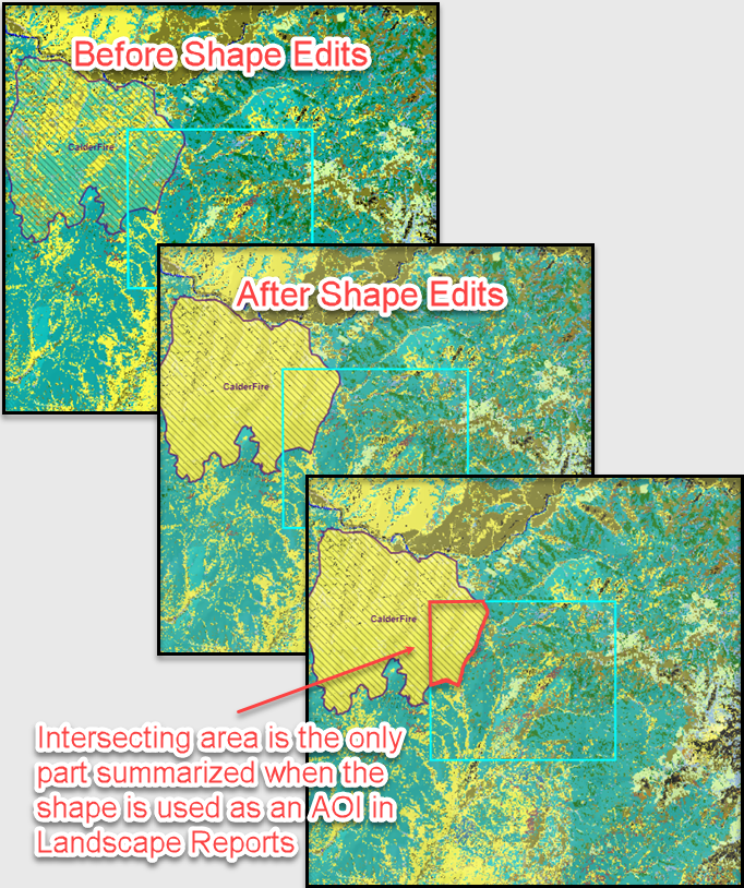
Edits are applied to your landscape as well as this buffer area, including landscape edits and edits constrained by a mask. However, note that reports generated for your landscape only include the area inside the blue landscape boundary. If an Area of Interest (AOI) is used in generating a report, only the region of the AOI that intersects the landscape area is analyzed and included in the report.
Buffering Terminology
Landscapes that are not buffered are identified throughout IFTDSS by the acronym "NB" appearing at the end of the landscape name. "NB" indicates "No Buffer." NB landscapes come into IFTDSS by way of:
-
Uploaded landscapes in which the "Apply Buffer" option was not used.
-
Landscapes created in earlier versions of IFTDSS (prior to the Version 3.1.1, 25 October 2018) before buffered was automatically added to created landscapes.