It is important to know that canopy cover, canopy base height, canopy bulk density, and stand height in IFTDSS refer to Forest canopy characteristics. If you are working in an area classified as shrub or grass by LANDFIRE, your cover and base height values are zero. However, when you export LCP data from IFTDSS, you have additional layers available including, the Existing Vegetation Cover (EVC) and Existing Vegetation Height (EVH) layers. These layers will reflect cover and height data for tree, shrub, and herb lifeforms.
There can still be confusing cases, as illustrated by the examples below:
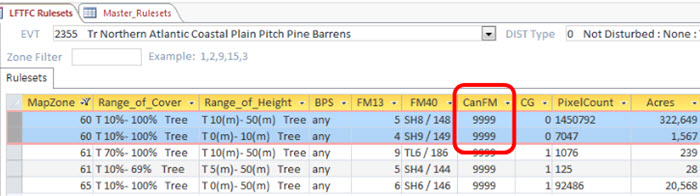
Example: No canopy cover in an area I know contains trees in New Jersey Coastal Pitch Pine Barrens
In IFTDSS, the stand height for much of this area is listed as zero, why are the trees not shown? Exporting the .LCP and examining it in Arcmap, there is an EVH reporting much of the area as pine barrens. However, the EVT for much of the area is classified as a non-forested fuel type.
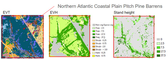
Based on the map zone, EVT, and very short tree heights, this area was classified as a shrub fuel type, which makes sense from a fire behavior perspective, but can be confusing from a vegetative perspective.
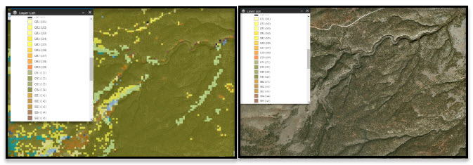
Example: 57 foot tall shrubs on the Blue Water Fire
In IFTDSS, much of the area is mapped as Fuel Model 122, a brush fuel model. However, there are stand heights of 7.5 meters, and in some places 17.5 meters. Zooming into the imagery base layer reveals that the area does indeed have some trees with associated stand heights. However, the brush fuel model appears correct from a fire behavior standpoint.