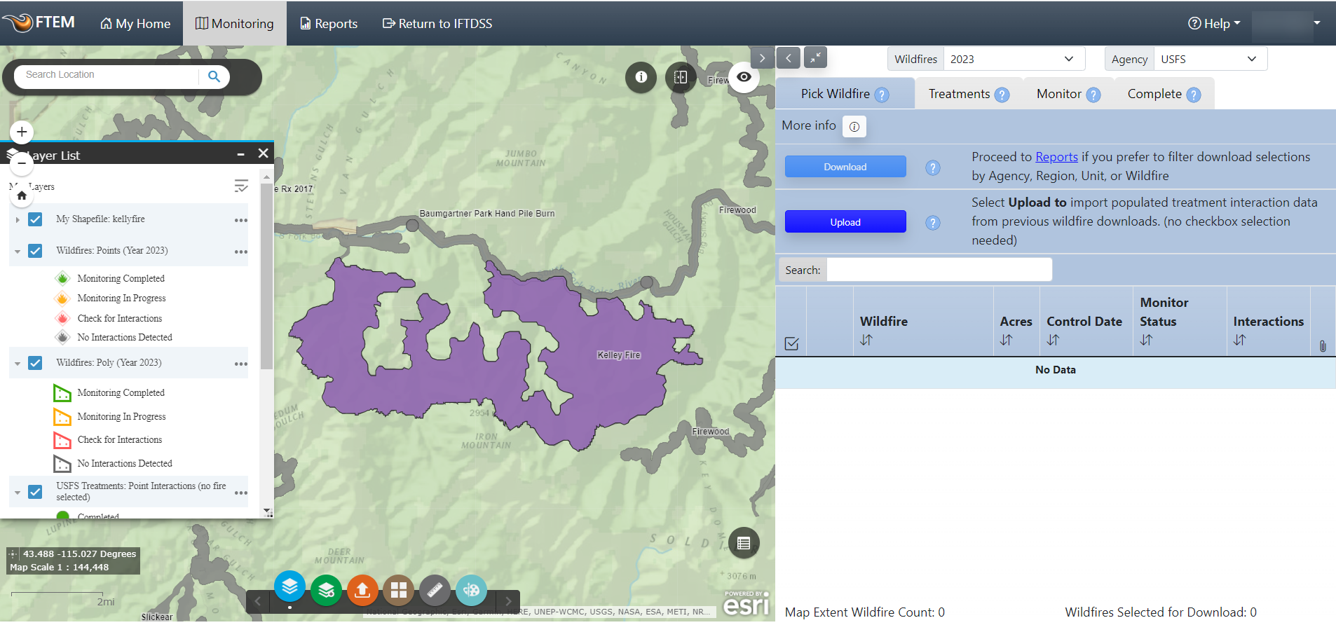
If your fire is represented as a point in FTEM, you may find it helpful to use a perimeter shapefile you have on your local computer if available. This will not save or update a fire perimeter in FTEM, but it can provide a helpful visual aid as your searching the area for treatment interactions.
Important! Note that this will not save your shapefile, it is intended to be viewed while working with wildfires in treatments in the FTEM system. To permanently add wildfires and treatments to FTEM, please contact your Agency Administrator, or visit the FAQ section addressing why fire perimeters may not be displayed.
To add a shapefile from your local computer:
- Click the Upload Shapefile widget
 .
. -
Click Upload.
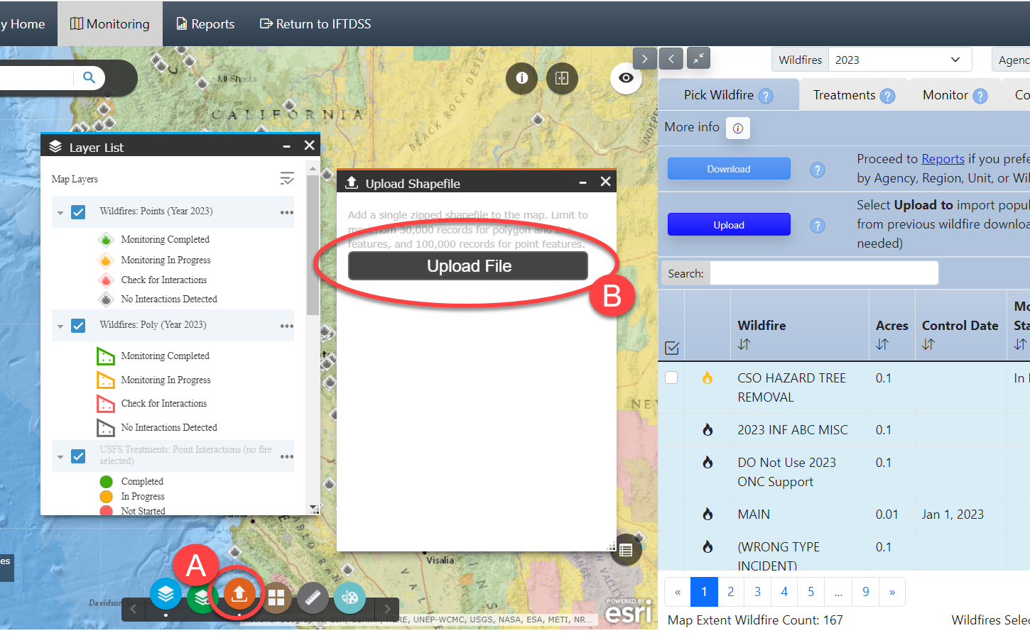
The FTEM Upload Shapefile widget
adds a shapefile to the map interface from your local computer. To add your shapefile, it must be compressed as a .zip file, and contain at least shp, .shx, .dbf, and .prj files. -
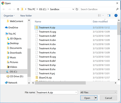
Search your local computer file directory, select it, and click Open.
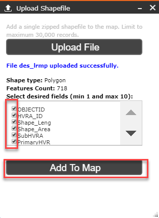
- Check any fields to include.
-
Click Create.
-
Your shapefile is added to the map and you are automatically zoomed to its extent.