Add Layers widget in Map Studio
With Add Layers you may add shapes or shapefiles you have created or uploaded to IFTDSS to your Layer List, or add enable existing IFTDSS reference data such as agency boundaries, wildfire activity, and other information. This task is often performed to view treatment unit boundaries, resources, or other shapefile information as you are working in Map Studio.
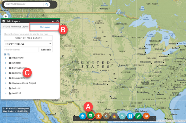
- From Map Studio, Click the Add Layers widget
 .
. - Select the My Layers tab which displays all of your shapes and shapefiles organized by the folder in which they are stored.
-
Select the folder for the file you want to add.
-
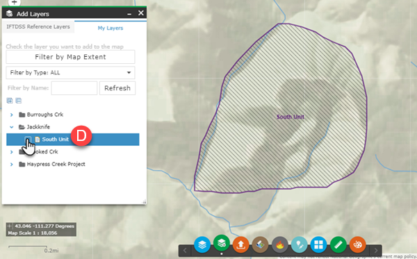
Click the checkbox next to the shape you need.
-
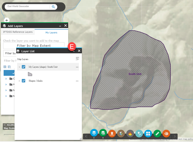
The map will zoom to your shapefile and it will be available in Layer List.
- Click Add Layers
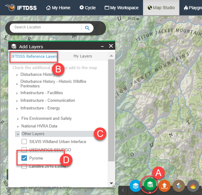
- Select the IFTDSS Reference Layers tab which displays all the reference layers available in IFTDSS. Scroll to the bottom of this page for a full list of current Reference Layers.
- Select the dropdown for the type of data you require.
-
Use the checkbox next to the specific data you require.
-
Your data will be displayed in Map Studio and on Layer List.
Disturbance History - Burn Severity
- RAVG - BA Percent Change
- RAVG - CC Percent Change
- RAVG - Composite Burn Index
- CONUS MTBS Burn Severity
- Alaska MTBS Burn Severity
- Hawaii MTBS Burn Severity
- Puerto Rico MTBS Burn Severity
Disturbance History - Fuels Treatments
- Fuel Treatment Polygons 2025
- Fuel Treatment Polygons 2024
- Historic Fuel Treatment Polygons 2023
- Fuel Treatment Polygons 2020-2022
- Fuel Treatment Polygons 2010-2019
- Fuel Treatment Polygons 2000-2009
Disturbance History - WFIGS Wildfire Perimeters
Important! To report a missing historic wildfire perimeter for 2025 or before, notify your agency's fire GIS contact.
- Fire Perimeters (WFIGS) Year to Date
- Fire Perimeters (WFIGS) 2025
- Fire Perimeters (WFIGS) 2024
- Fire Perimeters (WFIGS) 2023
- Fire Perimeters (WFIGS) 2020-22
Disturbance History - Interagency Wildfire Perimeters (IFPH)
- Fire Perimeters (IFPH) 2020
- Fire Perimeters (IFPH) 2010-2019
- Fire Perimeters (IFPH) 2000-2009
- Fire Perimeters (IFPH) 1990-1999
- Fire Perimeters (IFPH) 1980-1989
- Fire Perimeters (IFPH) 1979 and Earlier
Communities
Infrastructure - Facilities
Infrastructure - Utilities
Infrastructure - Recreation
- National Historic Trails
- Recreational Trails - USGS
- National Recreation Trailheads
- National Scenic Byways
- National Scenic Trails
- USFWS Trails
Designated Areas
- Wilderness
- BLM Grazing Allotments
- BLM Horse and Burro Areas
- National Recreation Areas
- National Wild and Scenic Rivers
- Other Designated Areas
- Inventoried Roadless Areas
- Wilderness Study Areas
Boundaries
- Protecting Units
- TNC Lands
- Jurisdictional Units (Zoomed Out)
- Jurisdictional Units (Zoomed In)
- Counties
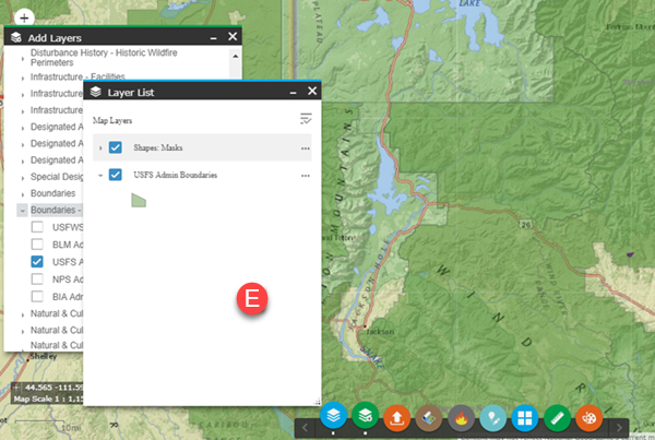
Boundaries - Federal Admin Areas
- USFWS Admin Boundaries
- BLM Admin Boundaries
- USFS Admin Boundaries
- NPS Admin Boundaries
- American Indian, Alaska Native, and Native Hawaiian Areas
- Geographic Area Coordination Centers (GACCs)
Natural & Cultural Resources - Habitat
Natural & Cultural Resources - Air Quality
- Class I Airsheds
- Non-Attainment Areas: Particulate Matter 2.5 (Annual)
- Non-Attainment Areas: Carbon Monoxide
- Non-Attainment Areas: Ozone (8-hr)
Fire Safety
- Firefighter Estimated Ground Evacuation Time
- Potential Control Locations (PCL)
- Snag Hazard
- Suppression Difficulty Index 97th (SDI)
- SILVIS Wildland Urban Interface
Unit Fire Planning
- Aquatic Fire Retardant Avoidance Areas (USFS Lands Only)
- Terrestrial Fire Retardant Avoidance Areas (USFS Lands Only)
- Fireshed
- Priority Landscapes
- Potential Operational Delineations (PODs) - polygons
- Potential Operational Delineations (PODs) - lines
- Spatial Fire Planning
- Pyrome
Fire Environment and Weather
National HVRA Data*
LANDFIRE Data Products
*Alaska omission: Air Quality, Ecosystem Function, and Infrastructure HVRA Sets are unavailable for the state of Alaska.
