Simulation Output Tools widget in Map Studio
The Simulation Output Tools widget ![]() allows you to view spatial modeling outputs within Map Studio.
allows you to view spatial modeling outputs within Map Studio.
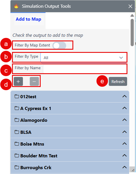
Filters
Using the controls at the top of the widget you can:
-
Filter by map extent by toggling the switch on or off
-
filter by model type using the dropdown menu
-
filter by name by entering a model output name
-
expand or collapse all outputs in the output list, or
-
refresh with the latest completed model outputs.
Add outputs to the map
-
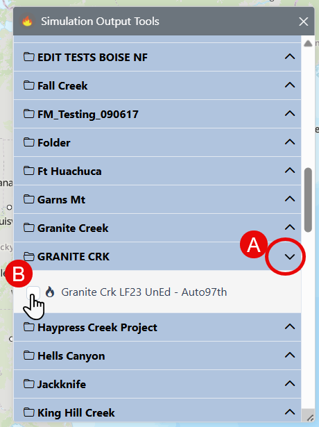
Scroll through the folder list or use filters to located the folder containing your model outputs and click the dropdown arrow on the right to view the model outputs in that folder.
-
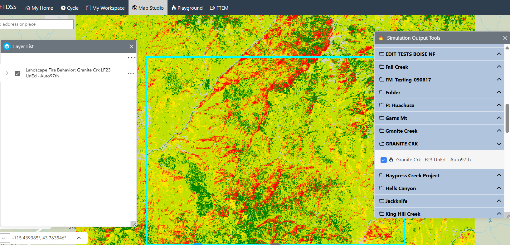
Use the checkbox to the left of the model outputs to add the output to Map Studio.
-
Choose the output or outputs display by selecting the checkbox next to your desired model output. This will add the output to Layer List and display it on the map.
Note: Model outputs in Not Submitted, Submitted, and Running status are also displayed in Simulation Output Tools, but are not available for selection until the model run has been successfully completed.