Opening an IFTDSS GeoTIFF file in ArcMap
Downloaded Geo Tiff files from IFTDSS will be .zip files. To begin, move the file to the desired folder on your local computer, and extract the contents.
Next, you may add the Geo Tiff bands to Arcmap. The below steps outline the process in ArcMap version 10.3, your version may vary slightly.
To add the Geo Tiff to ArcMap:
-
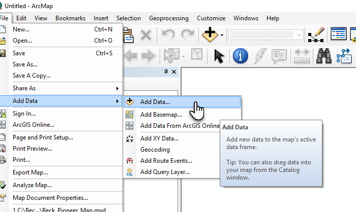
Start by going to the Add Data prompt in ArcMap.
-
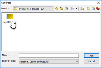
Navigate to your extracted Geo Tiff file.
-
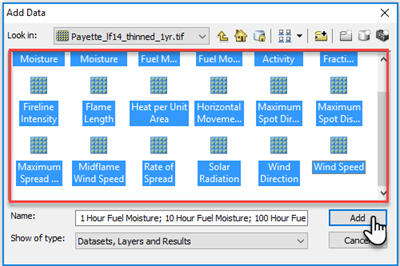
Double click the raster to reveal individual bands. Each of these bands corresponds to a landscape feature or model output (such as canopy cover, flame length, etc.).
-
Select all the individual bands and click Open.
-
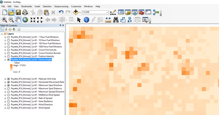
The individual bands will now be visible in ArcMap.
For instructions on how to reclass outputs such as flame length in ArcMap, see Reclassing GeoTIFF Features in ArcMap.