Preparing IFTDSS Landscapes in ArcPro for use in Google Earth Pro
Important! Before being able to conduct the steps below, you must first open the landscape in ArcPro then apply symbology to it.
The process outlined below is intended for use with a single landscape feature, such as Fuel Model.
-
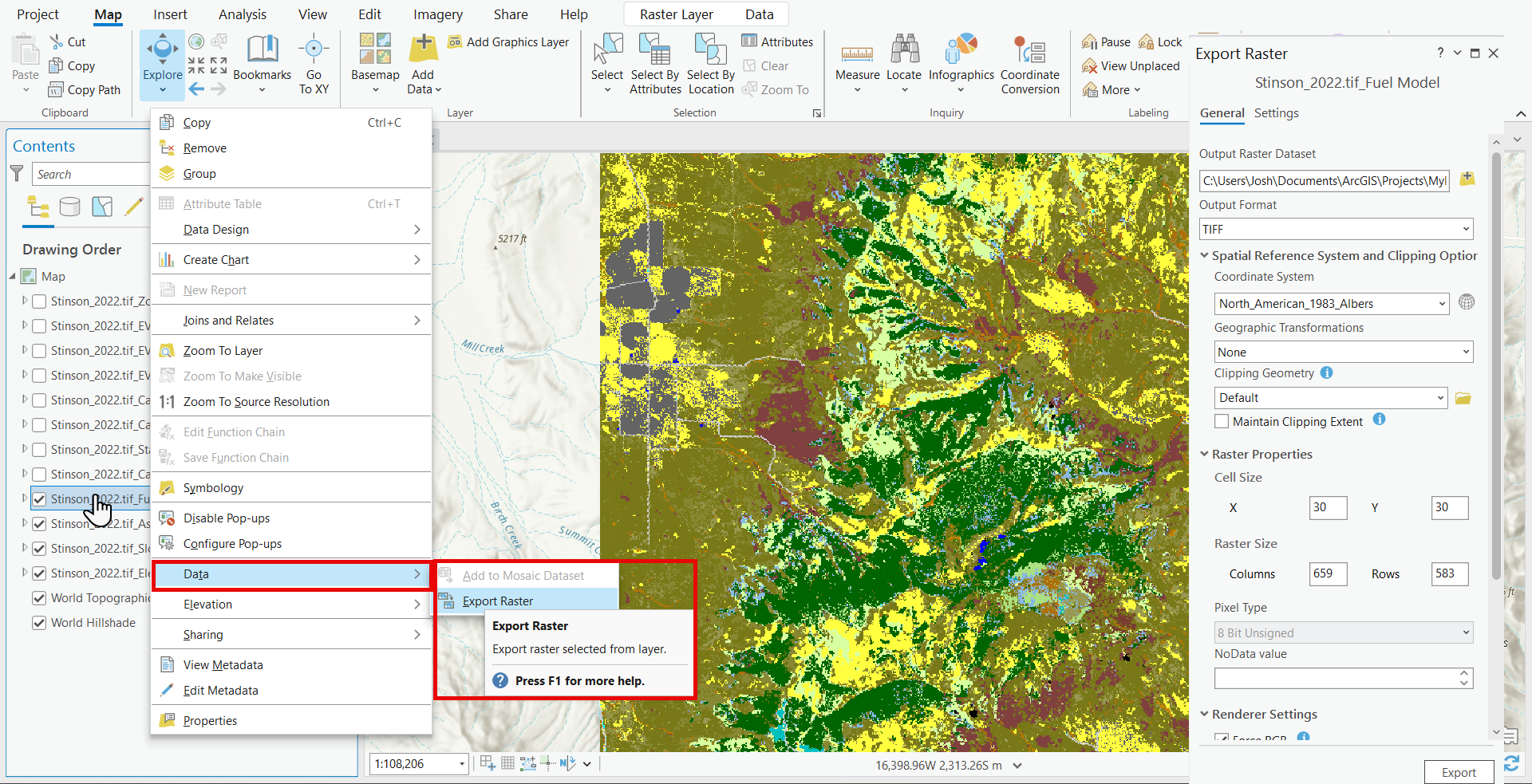
From ArcPro, with the landscape open and symbology applied, right-click on the landscape layer and select Data, then Export Raster to open the Export Raster pane.
-
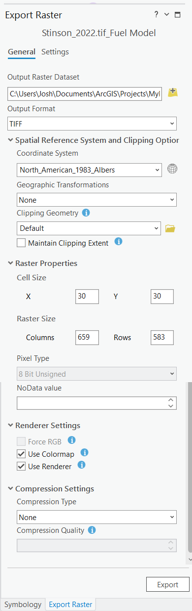
Ensure the following options in the Export Raster pane are set:
-
Output Format: TIFF.
-
Renderer Settings: uncheck "Force RBG."
-
Renderer Settings: check the box for "Use Colormap."
-
Renderer Settings: check the box for" Use Renderer."
-
Specify the location where you'd like to store the new file and click Export.
-
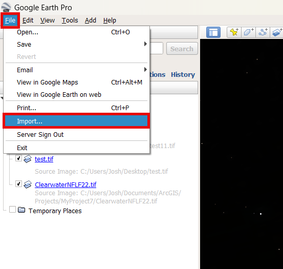
Open Google Earth Pro, navigate to File, and select Import.
-
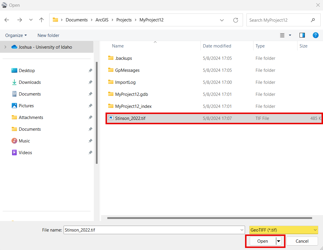
In the file selection window, select your GeoTIFF and click Open.
Tip: You may have to specify the file type as "GeoTIFF" in the bottom right of the file explorer in order to view the TIFF file.
-
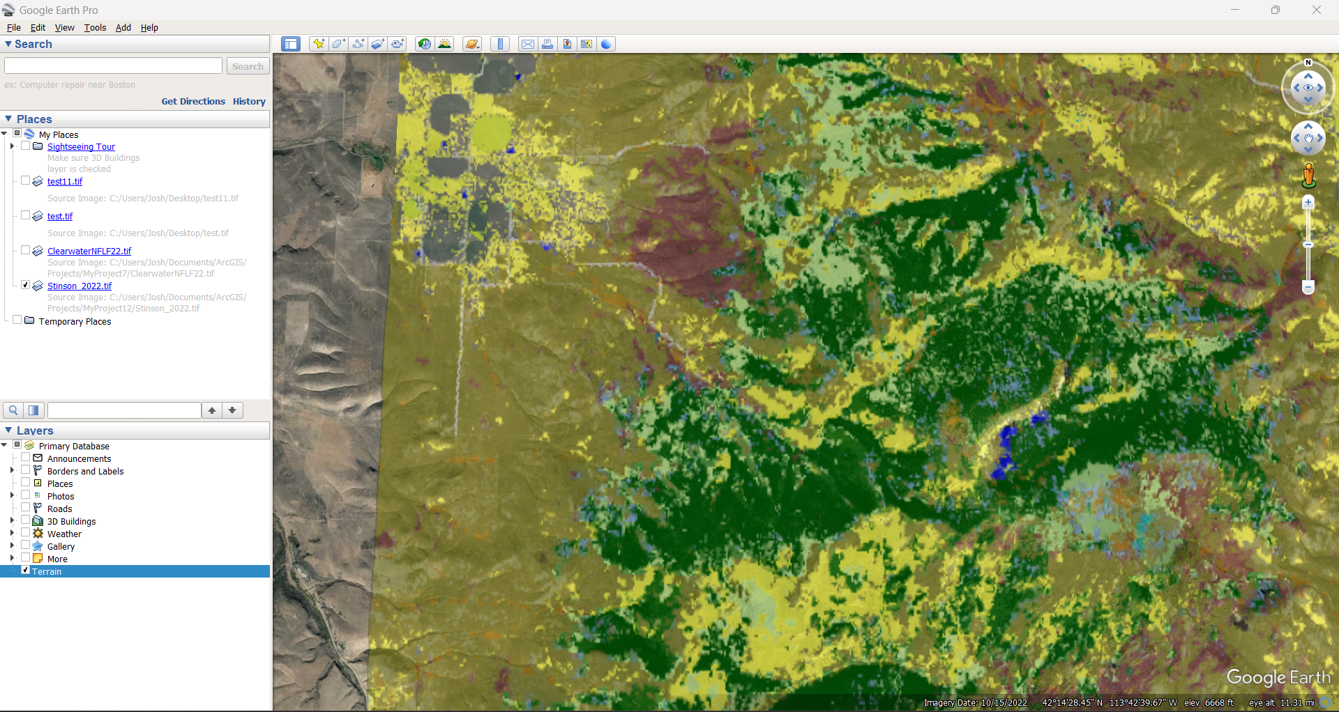
The landscape is now visible in Google Earth Pro.