Important! LBP is intended to be used to gauge fuel treatment effectiveness, integrated hazard and/or wildfire risk. Inputs should represent the “worst case scenario” or “problem fire” conditions. Potential sources of initial fuel moistures, wind speed and wind direction could include:
- Wind speed and wind direction calculated in Fire Family Plus from a local RAWS using historic weather from the past 10 to 20 years representing 90-97th percentile conditions.
- Wind speed and wind direction from a known ‘problem fire’ on a day of maximal growth.
- Predefined initial fuel moistures for very dry or dry conditions (Scott and Burgan 2005) in combination with known or predicted worst case scenario wind speed and wind direction.
Fire behavior in IFTDSS, driven by FlamMap, uses the following when inputs to calculate fire behavior:
- Wind speed - The speed of wind, in miles per hour, 20 feet above open level ground or above the average height of vegetation.
- Wind direction - The direction from which the wind is coming, expressed in degrees (for example, wind from the south would be expressed as a wind direction of 180 degrees).
The calculations use midflame wind speed, which is derived from the 20 foot wind speed entered. For each cell in the landscape, a wind adjustment factor, based on canopy height and canopy cover, is applied to convert the 20 foot wind speed to a midflame wind speed. Note that wind direction for each cell is modeled over space, the wind is not changing over time.
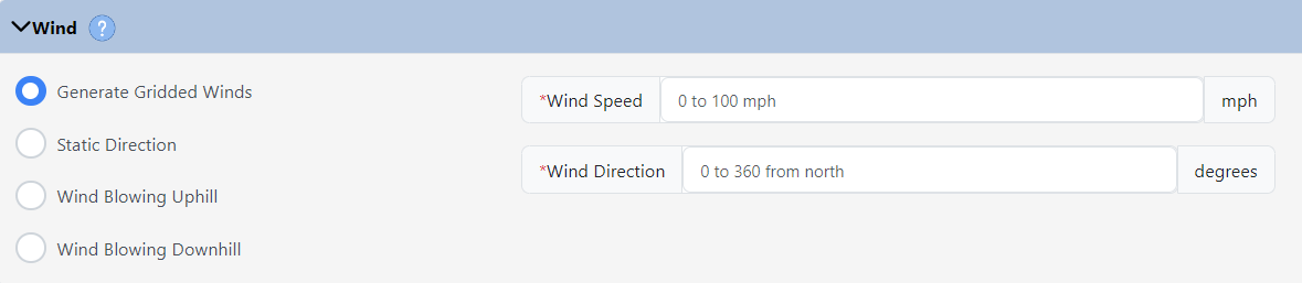
When calculating fire behavior there are four options for wind direction. Each option has its strength depending upon the circumstances:
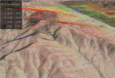
Gridded Winds (a.k.a WindNinja)
Selecting Generate Gridded Winds (USFS 2018) uses WindNinja to compute spatially varying winds across your landscape based on topographic change as well as a drag effect that vegetation has on wind flow. All of the layers within the landscape file are used to determine the wind direction for each cell.
Gridded wind direction is used to model complex terrain winds. For example, if you need to take into account funneling in a narrow canyon.
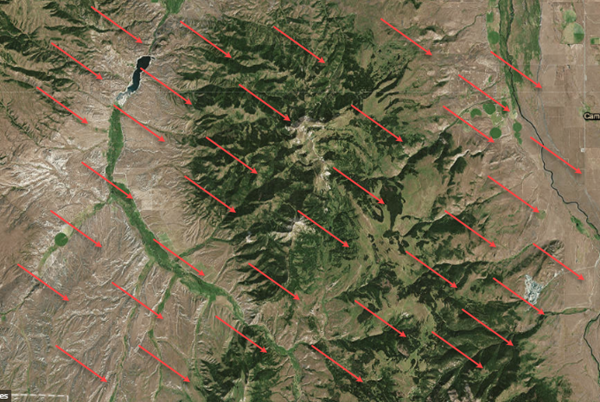
Static Direction
Selecting Static Direction applies the same wind direction for every cell in the analysis area. IFTDSS uses the 20 foot wind direction you provide.
This option would be most appropriate for modeling fire behavior on a flat terrain where topography and diurnal wind patterns are not a concern.
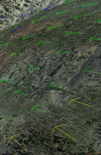
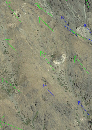
Wind Blowing Uphill
Selecting Wind Blowing Uphill applies the wind direction uphill based on aspect, which is part of the landscape file. Flat cells, with no aspect, use the direction you specify in the wind direction field.
This option would be appropriate for modeling the fire behavior with simple diurnal winds, a pattern where warming air generates winds moving uphill during the day. Uphill winds can also be used to calculate a near-maximum fire behavior characteristics.
Wind Blowing Downhill
Selecting Wind Blowing Downhill applies the wind direction down hill based on aspect, which is part of the landscape file. Flat cells, with no aspect, use the direction you specify in the wind direction field.
This option would be appropriate for modeling the fire behavior with simple diurnal winds, a pattern where cooling air generates winds moving downhill at night.