Dead Fuel Moisture shows the fuel moistures used to run the model. Dead Fuel Moisture is viewable in Map Studio (see images below) and available in the download package. Fuel moisture is the moisture content of dead woody fuels, it is the mass of water within the fuel particle expressed as a percentage of the fuel particle’s oven-dry mass. There are three classes of dead woody fuels based on diameter:
- 1-hr (0 to ¼ inch or 0 to 6.4 mm in diameter).
- 10-hr (¼ to 1 inch or 0.6 to 2.5 cm in diameter).
- 100-hr (dead woody fuel 1 to 3 inches or 2.5 to 7.6 cm in diameter).
In Map Studio, the same classification is used for all three time lag classes. Fuel moisture is displayed by 1% classes through 12%, then based on moisture of extinction break points for the higher classes (Albini 1976).
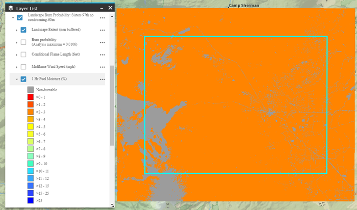
The example map below shows 1-hr fuel moisture where dead fuel moisture conditioning was not used. There are only two 1-hr values on the map, 3% and non-burnable, this is because the initial fuel moisture entered for the model run is used across the entire landscape.
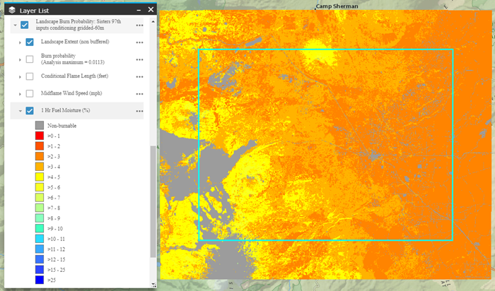
In the map (below) the same area is shown where dead fuel moisture conditioning using the Extreme classification was applied. Everything else with the model run remained unchanged. The 1-hr fuel moistures range from >2% to <6%.
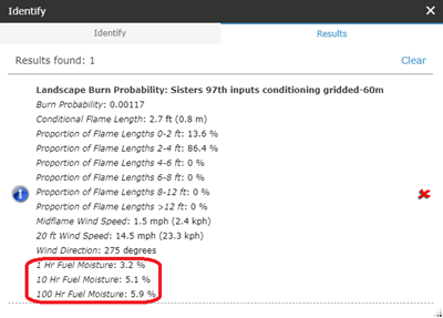
If you are interested in the exact fuel moisture value of a point on the map, the Identify widget can be used in Map Studio.
In the download package, 1-hr Fuel Moisture, 10-hr Fuel Moisture, and 100-hr Fuel Moisture are each bands in the GeoTIFF. They have continuous values as a fraction (i.e. 3.2% would be 0.032 in the GeoTIFF). Where non-burnable pixels exist, the value is -1.