About Selecting Fires from the Wildfire List
This topic summarizes:
Steps of Selecting Fires from the Wildfire List
-
Select a wildfire year, the year the wildfire was declared under control, contained, or extinguished.
-
(Optional) If you are affiliated with multiple agencies, filter your results by agency. If you are not an administrator or dual agency editor, this option may not be visible.
-
(Optional) Use the wildfire search field to further constrain your results by entering the fire name. Note the search field turns yellow when you begin typing.
Tip: In addition to the search field, you may also filter the fire list to locate and view additional fire information, or filter in the map view.
-
Select a wildfire from the Wildfire tab clicking anywhere in the row. The row for the selected fire will turn turquoise.
This auto-populates the next tab, Treatments, with a list of all treatments that overlapped selected fire. See the Buffering Rules documentation for more information on how treatments are auto-populated.
-
(Optional) Click the Zoom To button to zoom to the fire on the map, or the Table Summary button to see a summary of the interactions for that fire.
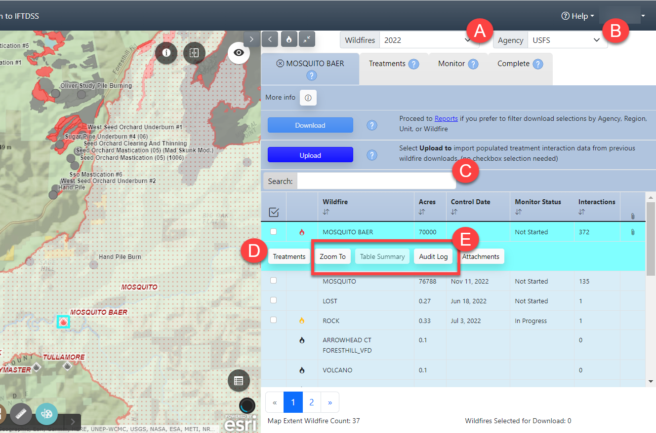
- Proceed to the Treatments tab by clicking the tab. You may also proceed to Treatments by clicking theTreatments button located under the wildfire name you've selected.
Tip: Need to de-select your fire? Move the mouse cursor to the Wildfire tab and click the black X to the left of the wildfire name.
Note: Attached files can be viewed, added, or downloaded at anytime if needed (see Attachments). Notice that each wildfire listed is followed by information, left to right, describing the number of acres, control date, monitor status, and the number of interactions.
Tip: Need to find a fire discovery date? That information can be found using the Identify widget ![]() , or moving the fire list to show up full screen to show the right hand panel metadata.
, or moving the fire list to show up full screen to show the right hand panel metadata.
Where Fire Data Comes From and How Often it Updates
Source
Wildfire data is pulled into the FTEM from:
- The National Incident Feature Services (NIFS) . This service provides fire perimeter (polygon) data, where it exists.
- The Integrated Reporting of Wildland Fire Information (IRWIN) data exchange service. This service provides point locations and fire-related data for fires across the United States.
Timing
Wildfire data is pulled into FTEM nightly.
Incorrect Fire Data
Wildfire data are pulled into the FTEMsystem nightly from:
-
The Integrated Reporting of Wildland Fire Information (IRWIN) data exchange service which provides point locations and fire-related data for fires across the United States.
-
The Wildland Fire Interagency Geospatial Services (WFIGS) - Interagency Fire Perimeters Dataset which provides the best available perimeters for all known wildland fires in the United States from 2021 and onward.
FTEM contains current active fires and fires that have been declared contained, controlled, or out.
Incorrect or missing fire information cannot be corrected directly in FTEM.
To correct a fire, contact your Situation Unit Leader (SITL) or Geographic Information Systems Specialist (GISS) to update the information in IRWIN or WFIGS. The correction will then be pulled into FTEM with 24 hours of the update.
Important! Some fire perimeters may not be approved by an incident or agency for public distribution (FeatureAccess <> Public, FeatureStatus <> Approved, IsVisible <>Yes). These perimeters are excluded from the WFIGS Interagency Perimeters dataset and subsequently FTEM.
For more detail see FTEM Wildfire Technical Documentation.