Attribute Table widget in Map Studio
Important! Currently, the Attribute table in IFTDSS is only available for vector files (shapes and shapefiles) not raster data (landscapes and model outputs).
During your analysis and assessments it can be helpful to view geospatial information in tabular data format. Most spatial data has multiple attributes that can be associated with the layer. The Attribute Table widget![]() in Map Studio displays a tabular view of operational layers' attributes and allows you to select, zoom, filter, and view specific tabular data elements. You may show or hide the attribute table at the bottom of your map by clicking the Attribute Table widget
in Map Studio displays a tabular view of operational layers' attributes and allows you to select, zoom, filter, and view specific tabular data elements. You may show or hide the attribute table at the bottom of your map by clicking the Attribute Table widget![]() .
.
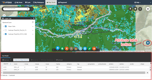
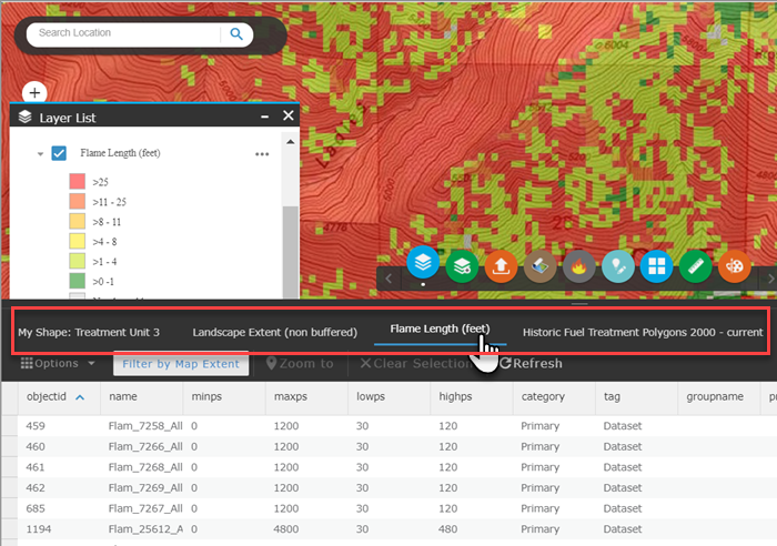
You may toggle between different geospatial files by clicking one of the open layers listed along the top of the table. All vector files open in your Map Studio session will be listed in this area, as shown below.
Attribute Table Functions
-
Filter by Extent: Toggles between the features shown in the visible portion of the map and the those in the full map extent.
-
Zoom To: Zooms to a selected attribute within Map Studio.
-
Clear Selection: Clears your selections in the Attribute Table.
-
Refresh: Refreshes the Attribute Table with the most current data.
-
Export to CSV: Exports the attributes to a CSV file. If records are selected, only the selected records are exported. If no records are selected, all the records are exported.
Important! Export to CSV will export a maximum of 1000 records.
-
Options: The following are available under Options
 :
:- Show Selected Records: Displays only selected records.
- Show or Hide Columns: This allows you to show or hide columns, you can also do this by clicking the + icon on the right side of the panel.
- Advanced Filtering: Allows you to filter records in the table. See Filtering Layers in the Attribute Table for a more details.