Downloading Quantitative Wildfire Risk Assessment (QWRA) Outputs
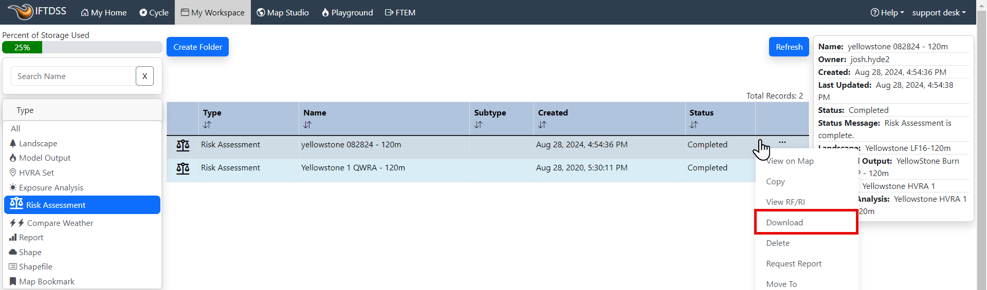
You can download your Risk Assessment (Quantitative Wildfire Risk Assessment, QWRA) outputs for use outside of IFTDSS. This can be done from My Workspace by clicking on the Risk Assessment file to show the file options, then clicking Download.
Downloading
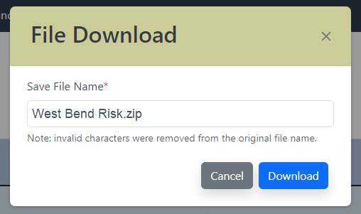
When the File Download window opens, by default the folder has the same Risk Assessment name you selected when running a QWRA. If you prefer to change the name for use on your computer you can click on the name field and type a different name, this does not change the name in IFTDSS.
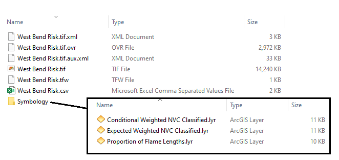
The individual files within the downloaded zip folder are prefixed with the original or modified <QWRA Name>. Once extracted, the folder includes:
| Output | File Type | Naming | Brief Description |
|---|---|---|---|
| Multiband GeoTIFF | .tif | <QWRA Name>.tif | QWRA outputs in raster format for use in ArcMap. |
| Table of HVRAs | .csv | <QWRA Name>.csv | A table listing the Primary HVRA Categories, Sub-HVRA names, Sub-HVRA short names, Response Functions, Relative Importance, Relative Extent, Relative Importance per Pixel and Overall Importance. |
| Symbology_ArcMap | folder containing .lyr files | <outputtype>.lyr | Symbology file for setting colors in ArcMap that match those used in IFTDSS. |
| Symbology_ArcPro | folder containing .lyrx files | <outputtype>.lyrx | Symbology file for setting colors in ArcGIS Pro that match those used in IFTDSS. |
The screenshot below shows an example of files in the downloaded zip folder for a Risk Assessment output. In the image, the <QWRA Name> was West Bend Risk.
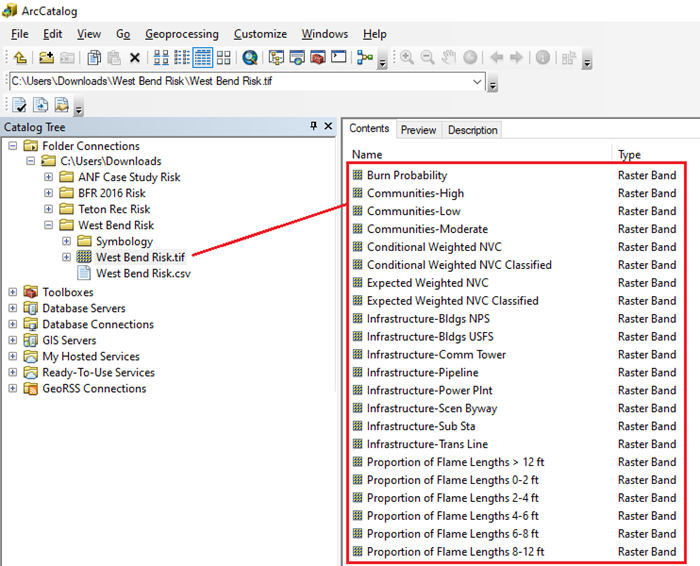
Layers (also known as bands) included in the GeoTIFF are listed in the table below.
| Band # | Band Name | Brief Description | Units - GeoTIFF | Units - IFTDSS (Report) |
|---|---|---|---|---|
| 1 | Conditional Weighted NVC A | The sum-product of value change (to one or more resources or assets) over a range of flame lengths. See the Conditional Weighted NVC topic for more detail. | unitless | unitless |
| 2 | Expected Weighted NVC A | Burn Probability times Conditional Weighted NVC. See the Expected Weighted NVC topic for more detail. | unitless | unitless |
| 3 | Conditional Weighted NVC Classified | Categorical version of the Conditional Weighted NVC output to enable mapping in a GIS to match Map Studio. | categorical | categorical |
| 4 | Expected Weighted NVC Classified | Categorical version of the Expected Weighted NVC output to enable mapping in a GIS to match Map Studio. | categorical | categorical |
| 5 | Burn Probability A, B | The likelihood that a fire will burn a given point on the landscape (expressed as a value between 0 and 1). See the Burn Probability topic for more detail. | proportion | proportion |
| 6 | Proportion of Flame Lengths 0-2 ft A, B | The probability of fire burning with a flame length between >0 and 2 ft (expressed as a value between 0 and 1). See the Proportion of Flame Lengths topic for more detail. | proportion | proportion |
| 7 | Proportion of Flame Lengths 2-4 ft A, B | The probability of fire burning with a flame length between >2 and 4 ft (expressed as a value between 0 and 1). See the Proportion of Flame Lengths topic for more detail. | proportion | proportion |
| 8 | Proportion of Flame Lengths 4-6 ft A, B | The probability of fire burning with a flame length between >4 and 6 ft (expressed as a value between 0 and 1). See the Proportion of Flame Lengths topic for more detail. | proportion | proportion |
| 9 | Proportion of Flame Lengths 6-8 ft A, B | The probability of fire burning with a flame length between >6 and 8 ft (expressed as a value between 0 and 1). See the Proportion of Flame Lengths topic for more detail. | proportion | proportion |
| 10 | Proportion of Flame Lengths 8-12 ft A, B | The probability of fire burning with a flame length between >8 and 12 ft (expressed as a value between 0 and 1). See the Proportion of Flame Lengths topic for more detail. | proportion | proportion |
| 11 | Proportion of Flame Lengths >12 ft A, B | The probability of fire burning with a flame length 12 ft (expressed as a value between 0 and 1). See the Proportion of Flame Lengths topic for more detail. | proportion | proportion |
| 12 | Sub-HVRA 1 | The rasterized version of the presence of a Sub-HVRA at the same resolution of the Landscape Burn Probability outputs. See the Exposure Analysis Technical Documentation for more detail. | unitless | unitless |
| 13 | Sub-HVRA n... | Each subsequent Sub-HVRA you use in the analysis will have its own band, there can be up to 100 Sub-HVRAs total within a GeoTIFF. | unitless | unitless |
A Non-burnable pixels are indicated with a value of -1.
B Burnable but not burned pixels are indicated with a value of 0.
The screenshot below shows an example of the layers in a Risk Assessment GeoTIFF in ArcCatalog. In the image the <QWRA Name> was West Bend Risk.