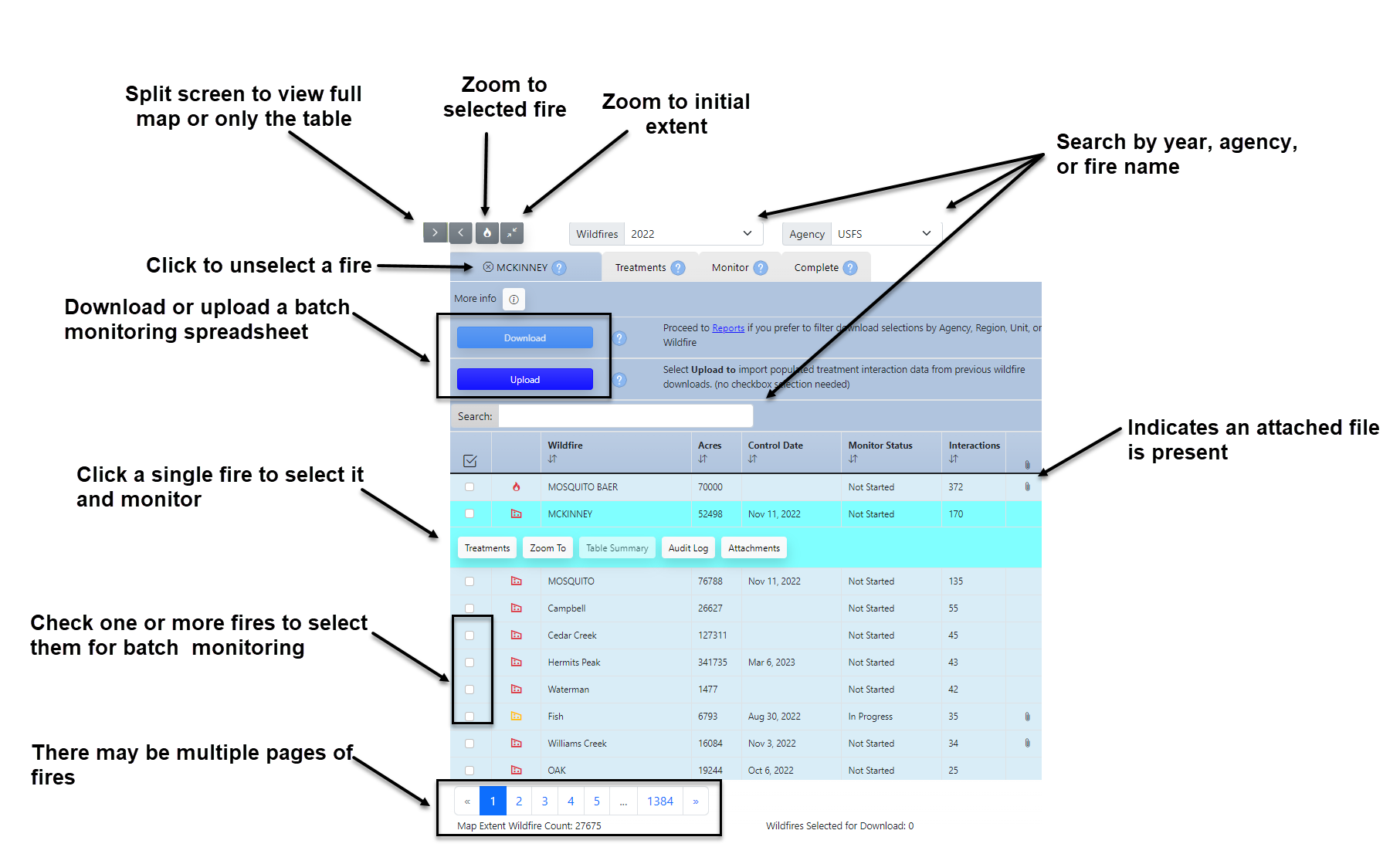
Monitoring Interface
FTEM Interface Controls
Each button and tab in the FTEM interface is labeled below:
Important! If you only see two tabs, you have Viewer role, and must request an Editor role from your FTEM profile to access the Monitoring and Complete tabs.
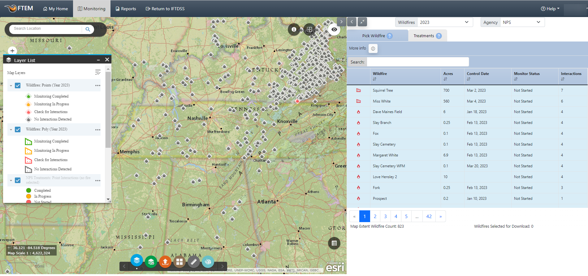
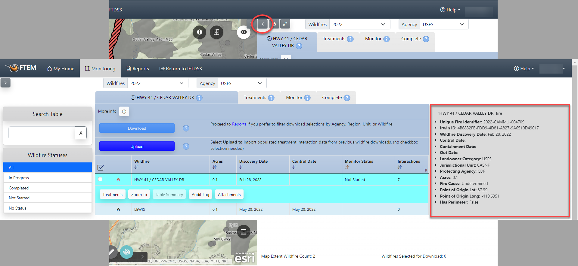
By default, the interface is split, displaying a map on the left, and monitoring tabs on the right. Change the interface at anytime to show only the tabs or only the map by clicking the split screen  buttons in the top of the screen just below the top navigation menu. Splitting the screen to only focus on the tabs also reveals a right hand panel displaying metadata, as shown below:
The default map layers visible include:
- Wildfire Points and Wildfire Polygons: Described in more detail in the wildfire data sources topic and wildfire technical documentation.
- Treatment Points and Treatment Polygons: Described in more detail in the treatment data sources topic and treatment technical documentation.
- Jurisdictional Units Reference Layer.