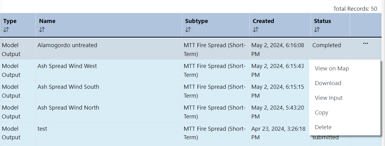
Minimum Travel Time Fire Spread (MTT) outputs can be downloaded for use outside of IFTDSS. This can be done from either My Workspace or My Modeling Playground by clicking on the model output file to show the file options, then clicking Download.
Downloading
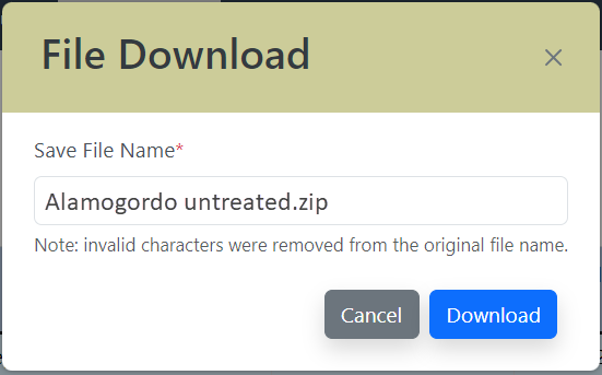
When the File Download window opens, by default the folder will have the same Run Name you specified when running MTT. If you prefer to change the run name for use on your on your computer you can click on the name field and type a different name, this will not change the name in IFTDSS.
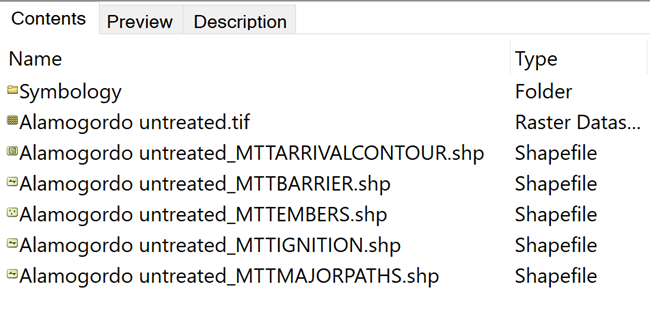
The individual files within the downloaded zip folder are prefixed with the original or modified <Run Name>. Once extracted, the folder includes:
| Output | File Type | Naming | Brief Description |
|---|---|---|---|
| Multiband GeoTIFF | .tif | <MTT Name>.tif | MTT outputs in raster format for use in ArcMap. |
| Arrival Time contour shapefile | .shp | <MTT Name>_MTTARRIVALCONTOUR.shp | Shapefile displaying each burn period. |
| Barrier shapefile | .shp | <MTT Name>_MTTBARRIER.shp | Shapefile displaying the barriers used (if any) in the MTT run. |
| Ember shapefile | .shp | <MTT Name>_MTTEMBER.shp | Shapefile displaying the ember landing locations. |
| Ignition shapefile | .shp | <MTT Name>_MTTIGNITION.shp | Shapefile displaying the ignitions used in the MTT run. |
| Major flow path shapefile | .shp | <MTT Name>_MTTMAJORFLOWPATHS.shp | Shapefile displaying the major flow paths for fire spread. |
| Symbology_ArcMap | folder containing .lyr files | <outputtype>.lyr | Symbology file for setting colors in ArcMap that match those used in IFTDSS. |
| Symbology_ArcPro | folder containing .lyrx files | <outputtype>.lyrx | Symbology file for setting colors in ArcGIS Pro that match those used in IFTDSS. |
| FMSF input file | .txt | <Run Name>.txt | Input file generated when IFTDSS requests model runs from the Fire Modeling Services Framework (FMSF). |
Note on MTT Outputs: Ember and Flow paths may appear in ArcMap as though they have different projections. This is only a naming discrepancy rather than a projection issue. See the issue in our Known Issues topic for more details.
The screenshot below shows an example of files in the download zip folder for aMTT model output. In the image the <Run Name> was "Alamogordo untreated."
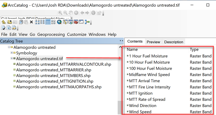
Layers (also known as bands) included in the GeoTIFF are listed in the table below.
| Band Number |
Output |
Description |
Map Studio - Units | Report - Units | Download - Units |
|---|---|---|---|---|---|
| 1 | MTT Arrival Time GridA, B | The time required for fire to travel from its ignition source to a particular cell. See the Arrival Time topic for more details. | burn period | burn period | minutes |
| 2 | MTT Rate of SpreadA, B | Spread rate of the fire as it encountered each cell along the minimum travel time path. See the Rate of Spread topic for more details. | chains/hr | chains/hr | meters/min |
| 3 | MTT Fireline IntensityA, B | Fireline intensity of each cell burned by the fire as it follows the minimum travel time path. See the Fireline Intensity topic for more details. | BTU/ft-sec | BTU/ft-sec | kW/m |
| 4 | MTT Ignition Grid | The raster interpretation of the ignition and barrier vectors used by the MTT model. See the MTT Ignitions topic for more details. | unitless | N/A | unitless |
| 5 | Midflame Wind Speed C | Wind velocity at the midflame height. Calculated using wind adjustment factors based on stand height and canopy cover and the Wind Speed. | mph | N/A | mph |
| 6 | 1 Hr Fuel Moisture A | Moisture content of 1-hour fuel (dead woody fuel 0 to ¼ inch or 0 to 6.4 mm in diameter) is the mass of water within the fuel particle expressed as a percentage of the fuel particle’s oven-dry mass. | percent | N/A | proportion |
| 7 | 10 Hr Fuel Moisture A | Moisture content of 10-hour fuel (dead woody fuel ¼ to 1 inch or 0.6 to 2.5 cm in diameter) is the mass of water within the fuel particle expressed as a percentage of the fuel particle’s oven-dry mass. | percent | N/A | proportion |
| 8 | 100 Hr Fuel Moisture A | Moisture content of 100-hour fuel (dead woody fuel 1 to 3 inches or 2.5 to 7.6 cm in diameter) is the mass of water within the fuel particle expressed as a percentage of the fuel particle’s oven-dry mass. | percent | N/A | proportion |
| 9 | Wind Direction | Wind direction is the direction from which the wind is blowing, specified in degrees increasing clockwise from north (which is zero degrees), Uphill or Downhill. Measured 20 feet (6 m) above the top of the tree or shrub canopy, or above the ground if canopy is absent. | N/A | N/A | degrees |
| 10 | Wind Speed | Wind velocity measured 20 feet (6 m) above the top of the tree or shrub canopy, or above the ground if canopy is absent. | N/A | N/A | mph |
A GeoTIFF values for non-burnable pixels are -1.
B GeoTIFF values for burnable but not burned pixels are 0.
C GeoTIFF values for non-burnable pixels are 0.
The screenshot below shows an example of the layers in a MTT GeoTIFF file in ArcCatalog. In the image the <Run Name> is "Alamogordo untreated."