Barriers - Minimum Travel Time Fire Spread (MTT) Input
Tip: Barriers are an optional input.
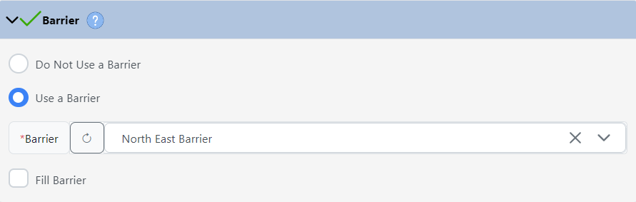
Barriers are used to create non-burnable areas that may not be represented on your landscape. For example, if you know a creek or road is a barrier to surface fire spread, but landscape data show some or all of the cells to be burnable, you could create and use a barrier. Note that while fire barriers will block surface fire spread, when spotting is used, torching trees could still cause the fire to spot over the barrier.
You must select your landscape prior to selecting a Barrier file. Available files are limited to:
-
Shapes you’ve created in IFTDSS or shapefiles you’ve uploaded. Lines and polygons are available as barriers.
-
Shapes or shapefiles that intersect your landscape, or the buffered area surrounding it.
-
A single shape or shapefile. The file may be single or multipart.
Important! Any file that is used as an Ignition will not be available to use as a Barrier.
Using Polygons
If a polygon is selected as a barrier, you will have the option to fill that polygon, making the interior unburnable.
Resolution and Raster Conversion
The Minimum Travel Time Fire Spread (MTT) model is a raster based model that converts ignition and barrier vectors to rasters prior to the model running. Line barriers will default to the same width as the cell resolution of your landscape. For example, a line barrier on a 30m landscape is 30m wide, a barrier on 60m landscape is 60m wide, etc.
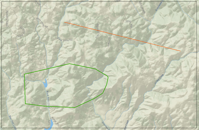
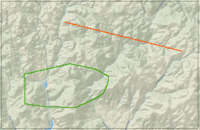
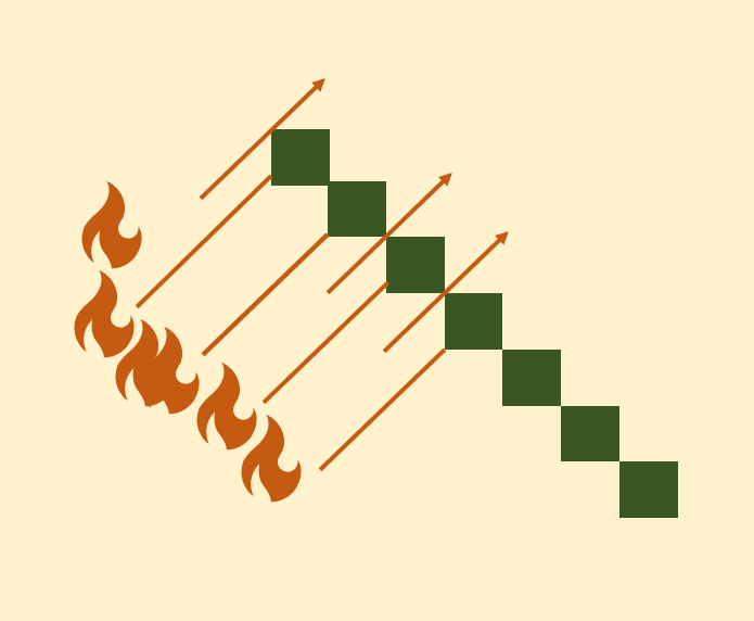
The images below show a before (image A) and after (image B) example of lines and polygons being converted to raster format.
-
Image A shows two vectors, a line used for ignition (orange) and a polygon used for a barrier (green), that were entered as inputs for a MTT run.
-
Image B shows those same inputs after they have been converted to grid format for running MTT. Note that the barrier polygon is hollow, indicting an outer barrier surrounding a burnable interior.
Important! Narrow barriers may still allow fire to pass through, see the information below for more detail.
A rasterized barrier has the potential for fire to “sneak” through the corners of rasters. If you need to simulate a fuelbreak of a certain width, a polygon may be preferable to a line barrier.
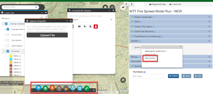
Creating a Barrier While Using the MTT Fire Spread Interface
In Split Screen, you may create points, lines, and polygons at anytime in the map interface and these features will automatically become available in the drop-down menus for the Ignition and Barrier inputs. This includes creating a shape, uploading a shapefile, creating a shapefile subset from the Layer List widget![]() , or from the Attribute Table. Split Screen is the default display mode for MTT.
, or from the Attribute Table. Split Screen is the default display mode for MTT.